
ABOUT SWUAV
Warning: Illegal string offset 'pins_more_option' in /www/wwwroot/swuav.ciimar.up.pt/wp-content/plugins/devvn-image-hotspot/admin/inc/add_shortcode_devvn_ihotspot.php on line 23
1. Exploratory surveys for sites and methodologies selection
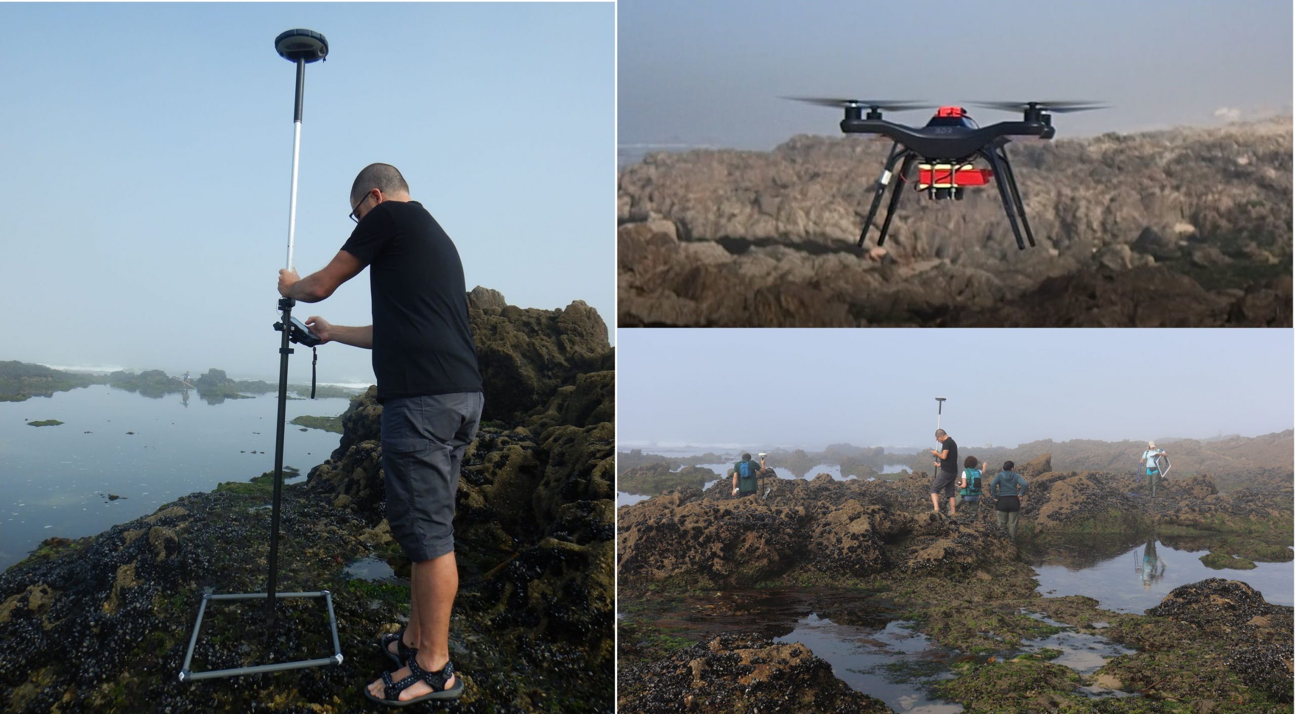
Exploratory Unmanned Aerial Vehicles (UAV) flights with RGB and Multispectral sensors were performed at a pilot rocky shore (Vila Chã, NW Portugal) as a preliminary approach to identify the metrics and procedures to use in the following surveys under a larger scale.
During each UAV flight, georeferenced quadrat frames were placed upon the biological objects to be classified (seaweed; mussels and rock; rock, barnacles and limpets; and sand) and photographed in-situ, for exploration of supervised classification techniques.
These flights were repeated at spring/summer and autumn/winter, in order to assess seasonal differences in the cover area of the classified objects.
2. Collection of spectral signatures of the class of objects to classify
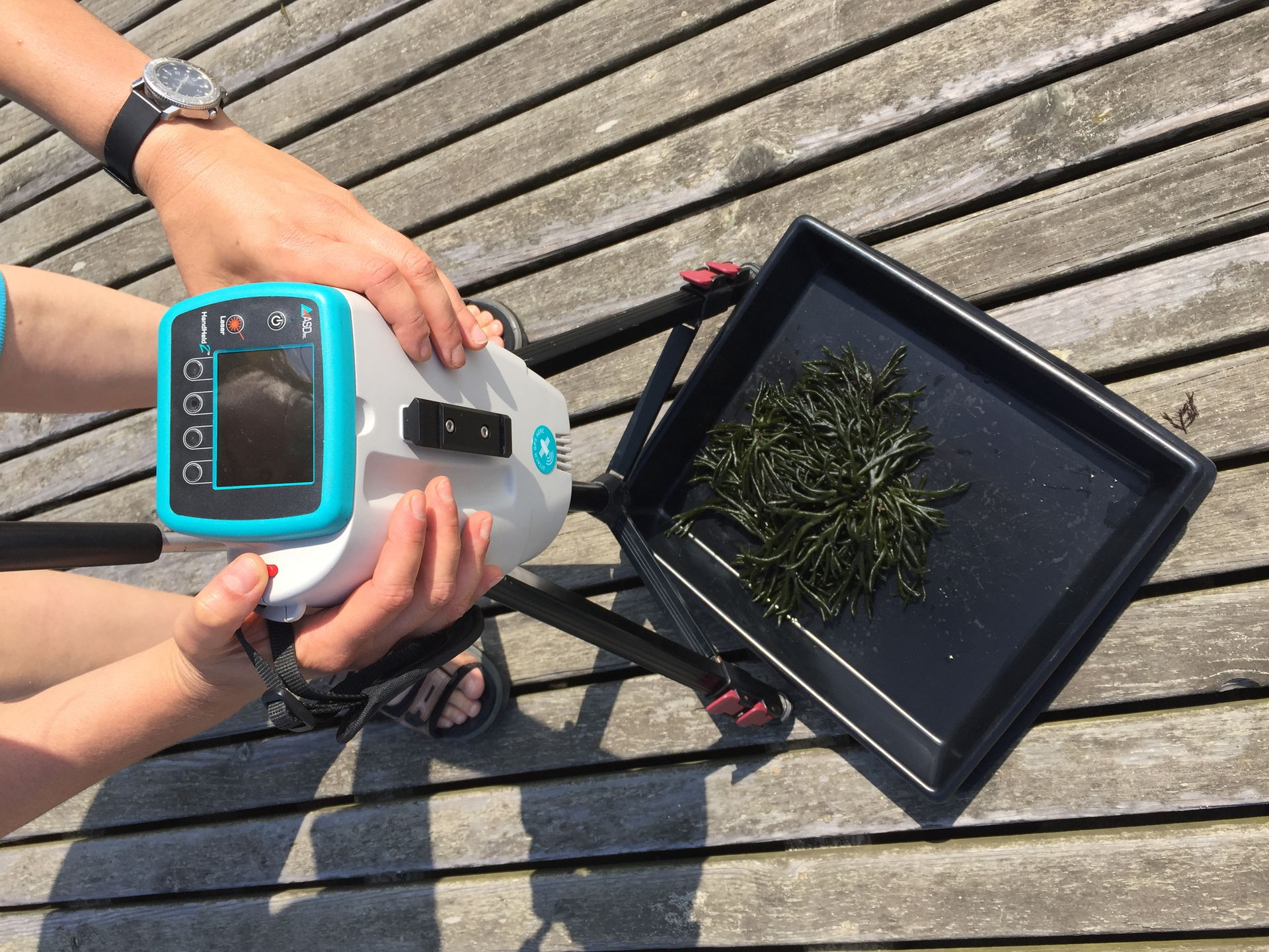
Each biological object has a unique spectral signature, measurable as reflectance, allowing future mapping discrimination once integrated with the aerial multispectral imagery.
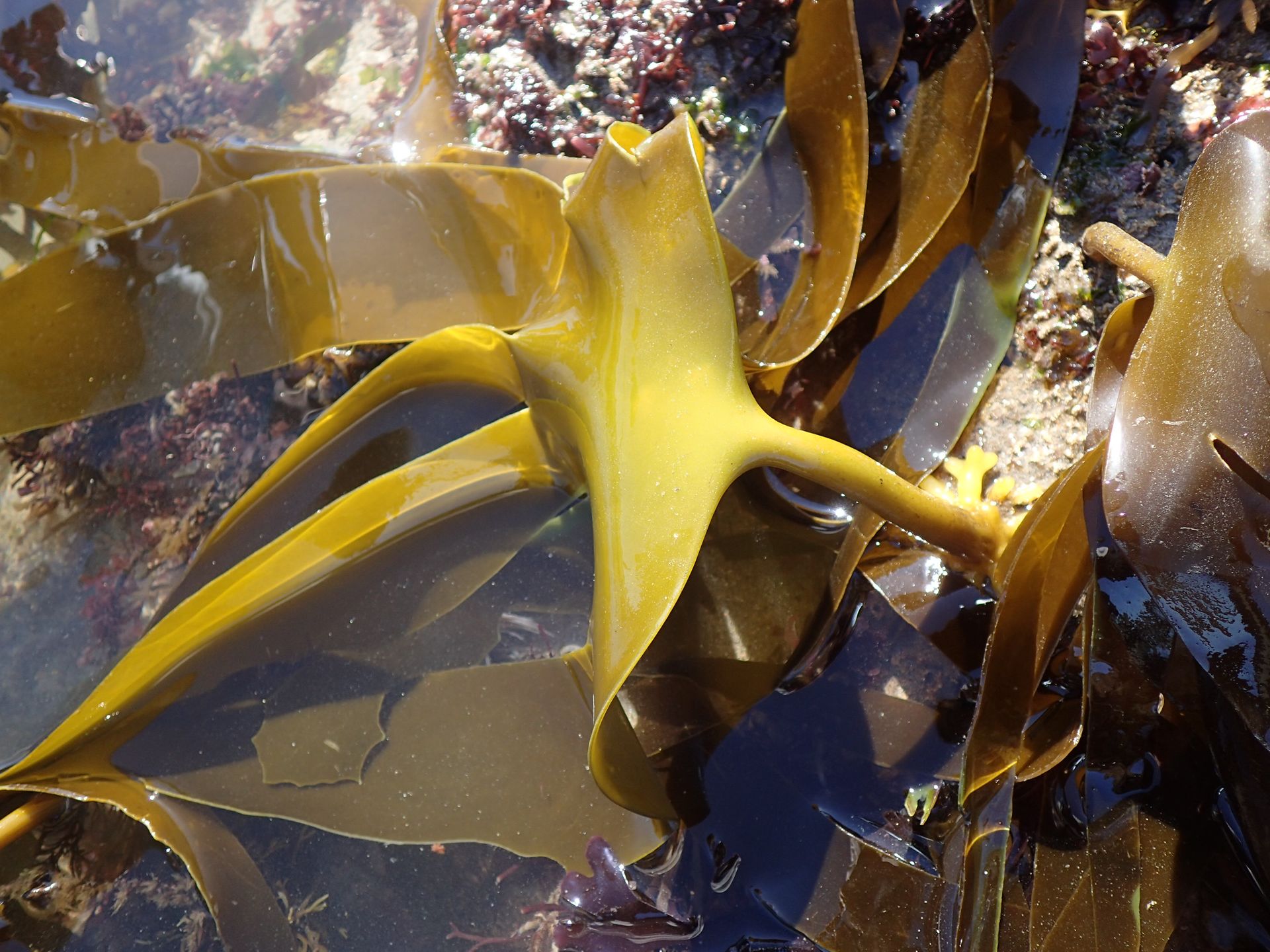
In-situ measurements of the reflectance spectra were performed for specimens of each seaweed group (green, red and brown; and within these the most abundant genera), under different ontogenic states, using a field spectroradiometer.
The influence of biomass variation on reflectance spectra was assessed by experimental addition and removal of portions of seaweed to a surface area matching the spectroradiometer ground field-of-view. Biomass was reported as dry weight per surface area and the mathematical relation between reflectance spectra and biomass was calculated for different seaweeds.
2. Collection of spectral signatures of the class of objects to classify
Each biological object has a unique spectral signature, measurable as reflectance, allowing future mapping discrimination once integrated with the aerial multispectral imagery.
In-situ measurements of the reflectance spectra were performed for specimens of each seaweed group (green, red and brown; and within these the most abundant genera), under different ontogenic states, using a field spectroradiometer.
The influence of biomass variation on reflectance spectra was assessed by experimental addition and removal of portions of seaweed to a surface area matching the spectroradiometer ground field-of-view. Biomass was reported as dry weight per surface area and the mathematical relation between reflectance spectra and biomass was calculated for different seaweeds.
3. Acquisition of base-line information with UAV equipped with RGB, multispectral and hyperspectral sensors
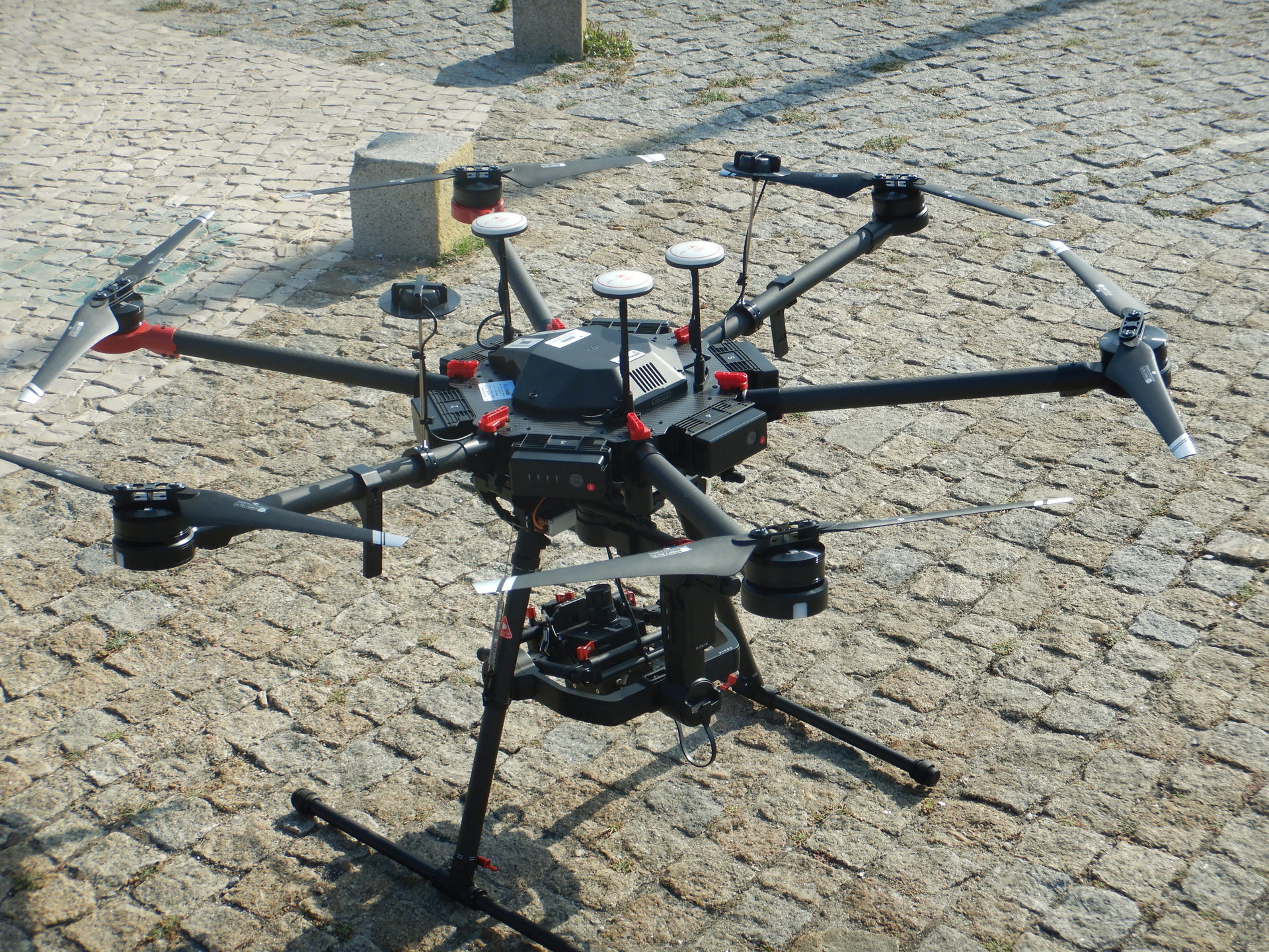
Hyperspectral sensors will be used additionally to RGB and multispectral sensors, at a larger scale, of about 1.5 Km, at two intertidal regions. Flights with UAVs equipped with these different sensors will be performed at the best height to retrieve the data under the best possible resolution.
At each flight, georeferenced quadrat frames will be used for exploration of supervised classification techniques, as in Task T.1. Seasonal flights will be conducted to assess temporal variability in seaweed physiological state and percentage cover of biological elements.
The hypothesis to be tested is that aerial digital signatures of seaweeds, retrieved from the above mentioned sensors, will vary for each group of seaweed - green, red and brown, and with their percentage cover and hence biomass. Validation will be performed using ground-truthing techniques (in-situ measurements).
4. Selection of methods for automatic classification of rocky shores objects suitable for a plugin development in QGIS software
Data collected in the previous tasks will be analysed and processed in order to classify, by unsupervised, supervised and segmentation techniques, the biological objects by means of several software packages for advanced geospatial data analysis, such as Grass, SAGA or Orfeo.
These programs can be accessed from within the QGIS, allowing the integration, in a GIS environment, of many other geographical data from different sources.
In order to facilitate the application of the different classification methods, a plugin for image processing will be developed within QGIS.
5. Validation of automatic classification methods included in the QGIS plugin by ground-truthing in the field
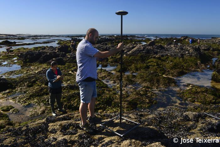
Traditional surveys for seaweed biomass stock assessment will be performed within the two intertidal regions evaluated in T.3. At specific sites, sampling quadrats will be used to assess seaweed percentage cover that will be converted to biomass using species specific correlations, developed by the research team. The area of seaweed beds (to estimate the total available biomass) will be assessed using a GPS device.
The data collected at these sites will be compared with the RGB and multispectral surveys results, calibrated by spectroradiometer and hyperspectral data gathered in previous tasks, following QGIS plugin integration.
Information will be assembled from all antecedent tasks and will validate a new methodology, the QGIS plugin, providing techniques that will enhance and speed-up the mapping of intertidal zone habitats.
Such techniques may be further used in coastal monitoring programmes to evaluate the extension and correspondent seasonal/temporal changes in biological assemblages.
6. Knowledge and skills transfers
Knowledge transfer will be promoted by dissemination of the main results through a wide audience by scientific international publications, conferences and seminars on remote sensing, GIS and marine biology to be held in Portugal or abroad. As part of the proposed dissemination and promotion plan a workshop will be held in CIIMAR at the end of the project.